Weather and Its Elements
Weather affects our daily lives in many ways, such as deciding what clothes to wear. For example:
- Winter calls for warm clothes.
- Summer calls for cool clothes.

Weather and Seasons
This chapter explains how we measure and monitor weather and why weather predictions are important. Weather predictions help us prepare for events like:
- Heavy rain
- Storms
- Droughts
- Heat waves
Understanding weather also helps people like farmers, pilots, sailors, and governments plan and stay safe.What is Weather?
Weather refers to the condition of the Earth’s atmosphere at a specific time and place. We describe weather using words like hot, cold, rainy, cloudy, humid, snowy, or windy.
- Atmosphere: The atmosphere is a layer of gases or air surrounding the Earth.
- Troposphere: This is the lowest layer of the atmosphere where all weather happens. It is 6–18 km thick, with it being thinner at the poles and thicker in the tropics. All plants, animals, and humans live in this layer.
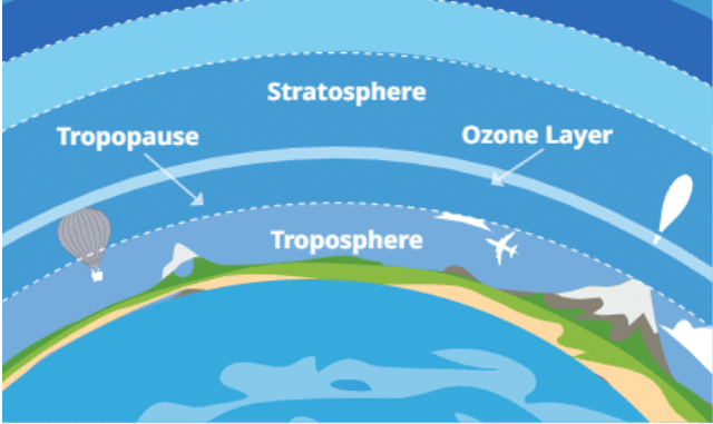
Troposphere
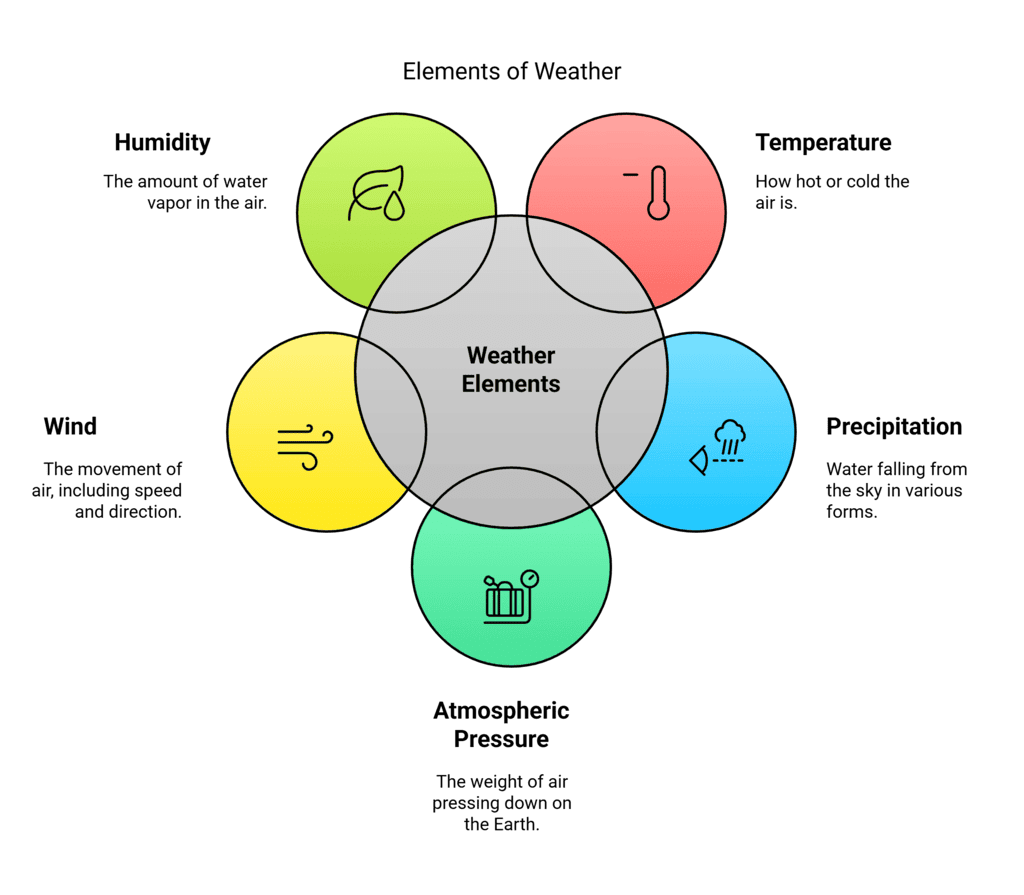
- The five main elements of weather are:
1. Temperature: How hot or cold the air is.
2. Precipitation: Water falling from the sky, like rain, snow, sleet, or hail.
3. Atmospheric Pressure: The weight of the air pressing down on the Earth’s surface.
4. Wind: The movement of air, including its speed and direction.
5. Humidity: The amount of water vapor (gaseous water) in the air.
- Since people experience weather differently (e.g., cold in Chennai may feel pleasant in Kashmir), we need standard ways to measure these elements.
- People have long observed nature to predict weather, like birds flying low, ants moving eggs, frogs croaking, or pine cones closing before rain.
- In India, traditional methods are still used to predict the monsoon.
Let’s Revise
Q: What is the troposphere and why is it important? View Answer
Q: What are the five main elements used to describe weather? View Answer
Weather Instruments
Scientists use special instruments to measure these elements of weather accurately.
a) Temperature:
- Measured using a thermometer, which shows how hot or cold it is.
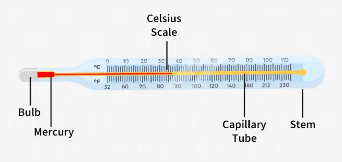
Clinical Thermometer
- Types include clinical and laboratory thermometers, using Celsius (°C) or Fahrenheit (°F) scales (e.g., 15°C = 59°F).
- Some thermometers measure ambient temperature, while others record maximum and minimum temperatures in a day.
- Digital thermometers are more precise and store more data.
Useful statistics include: - Range: Maximum temperature minus minimum temperature in 24 hours.
- Mean daily temperature: (Maximum + Minimum) ÷ 2.
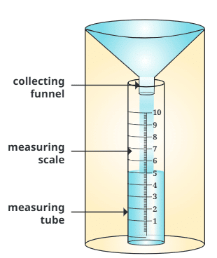
b) Precipitation:
- Measured using a rain gauge, which collects rainwater in a cylinder through a funnel.
Rain Gauge - A scale measures the depth of water (e.g., 5 mm of water means 5 mm of rainfall).
- For snow, it is melted before measuring.
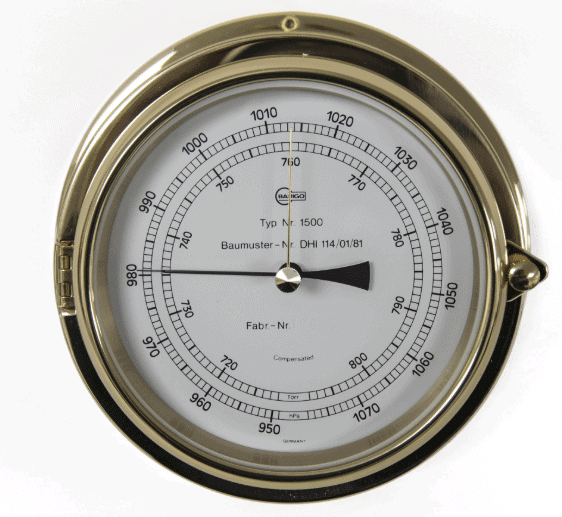
c) Atmospheric Pressure:
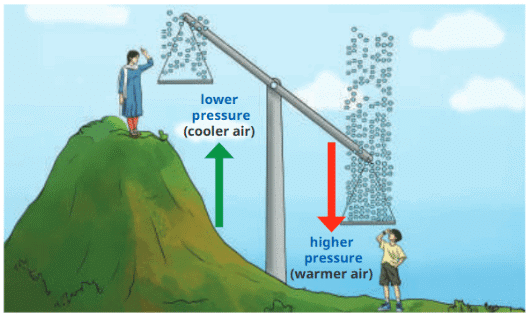
- The weight of air pressing down, felt as “heavy” weather before storms.
- Atmospheric Pressure is higher near sea coasts and lower in mountains, where air is thinner with less oxygen, causing breathlessness at high altitudes.
- Low pressure can form a depression or low-pressure system, leading to storms or cyclones.
- Measured using a barometer in millibars (mb). Normal pressure at sea level is about 1013 mb; below 1000 mb indicates a depression.
Barometer - Important for people like mountaineers or soldiers at high altitudes (e.g., Khardung La in Ladakh at 5600 m has about 650 MB).
Let’s Revise
Q: What instrument is used to measure temperature and how does it work? View Answer
Q: How is precipitation measured and what does a reading of 5 mm mean? View Answer
d) Wind:
- Wind is the movement of air from high-pressure to low-pressure areas, with speed and direction.
Movement of Wind - Important for pilots, sailors, farmers, and weather forecasting, as it affects rain, soil drying, and seed dispersal.
- Wind vane (or weather vane) shows wind direction with a pointer and tail that turns when wind blows.
- Wind sock is a type of wind vane used at airports or industries.
- Anemometer measures wind speed with rotating cups; faster rotation means stronger wind, measured in km/h.
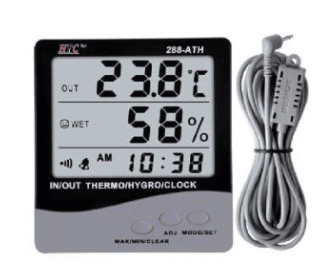
e) Humidity:
- The amount of water vapor in the air, affected by temperature, wind, pressure, and location.
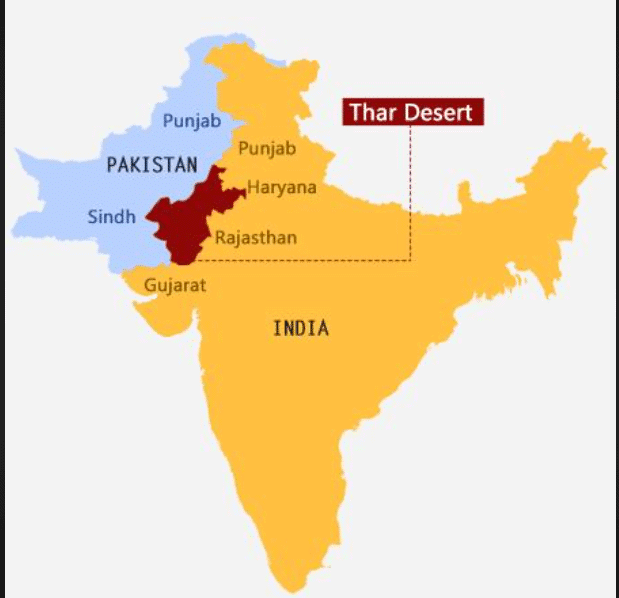
- High humidity (e.g., in coastal Kochi) slows evaporation, while low humidity (e.g., in dry Jaipur) speeds it up.
- Measured as relative humidity: 0% (no water vapor, impossible naturally) to 100% (air saturated with water vapor).
- Dry weather is 20–40% humidity; humid weather is 60–80%.
- Measured using a hygrometer, important for food processing and museums to keep items dry.
Hygrometer - High humidity (e.g., 84% in Kochi) makes clothes dry slower and causes more sweating than lower humidity (e.g., 52% in Delhi).
Try yourself:
What instrument is used to measure atmospheric pressure?
- A.Thermometer
- B.Barometer
- C.Rain gauge
- D.Anemometer
View SolutionWeather Stations
A weather station combines instruments like thermometers, rain gauges, barometers, anemometers, and hygrometers to measure weather at one place. Readings are taken regularly to track and forecast weather.
Weather StationAutomated Weather Station (AWS)
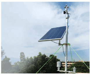
- An Automated Weather Station (AWS) uses sensors to measure temperature, humidity, wind, precipitation, and pressure without human help.
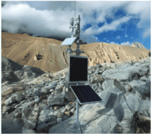 AWS at a Glacial Lake of Sikkim
 - AWS is used in agriculture, aviation, navigation, and environmental monitoring for accurate, timely data.
- In 2023, an AWS was set up at a glacial lake in Sikkim at over 4800 meters to warn about weather changes.
Try yourself:
What does an Automated Weather Station (AWS) measure?
- A.Cloud cover
- B.Only rainfall
- C.Temperature and humidity
- D.Wind only
View SolutionPredicting the Weather
Meteorologists collect data from weather instruments over time to predict weather using scientific methods. Predictions are vital due to climate change, which causes more extreme weather like droughts, floods, and cyclones.
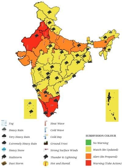
Weather Warning for India on 19 May 2024Accurate predictions help:
- Warn fishermen about stormy seas.
- Evacuate coastal areas before cyclones.
- Allow governments to prepare resources for disasters.
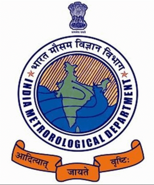
The India Meteorological Department (IMD), set up in 1875, issues weather warnings (e.g., a map from 19 May 2024 showed heat waves and severe weather in some states). IMD’s motto, “From the sun arises rain”, reflects how the sun heats water to form rain clouds.
IMDPoints to Remember
- Weather is described by five main elements: temperature, humidity, precipitation, wind, and atmospheric pressure.
- Special instruments like thermometers, rain gauges, barometers, anemometers, and hygrometers are used to measure these elements accurately.
- Data from these instruments help us monitor and predict the weather.
- Weather elements dominate at different times: rainfall in July, temperature in May or December, and wind during hot loo winds or forest fires.
- Weather stations, including Automated Weather Stations (AWS), provide accurate weather data and forecasts.
- Weather is linked to climate, which will be discussed in the next chapter.
Difficult Words
- Weather: The condition of the atmosphere at a specific time and place.
- Atmosphere: The layer of gases (air) surrounding the Earth.
- Troposphere: The lowest layer of the atmosphere where weather happens.
- Precipitation: Water falling from the sky, like rain, snow, sleet, or hail.
- Atmospheric Pressure: The weight of air pressing down on the Earth’s surface.
- Humidity: The amount of water vapor in the air.
- Thermometer: An instrument that measures temperature.
- Rain Gauge: A tool that measures the amount of rainfall.
- Barometer: An instrument that measures atmospheric pressure.
- Wind Vane: A tool that shows the direction of the wind.
- Anemometer: An instrument that measures wind speed.
- Hygrometer: A tool that measures humidity.
- Weather Station: A setup with multiple instruments to measure weather elements.
- Meteorologists: Scientists who study and predict weather.

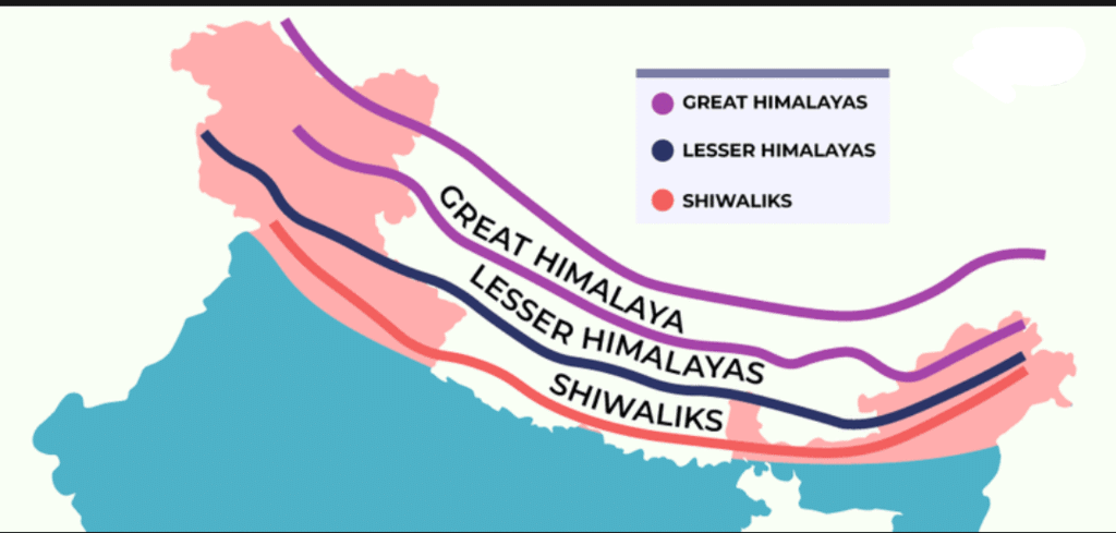

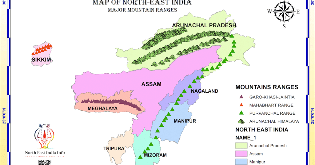
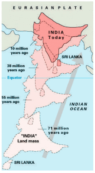 India’s collision with Eurasia around 50 million years ago formed the Himalayas.
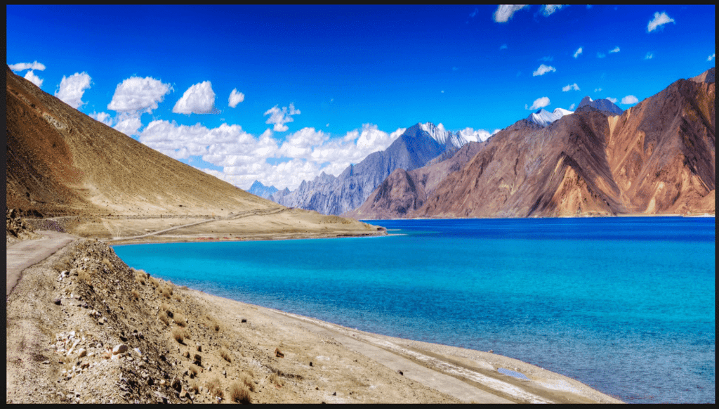
 View Answer