06. Population – Short Questions answer

Q.1. What was India’s population on March 2001?(Census 2001)

1028 million.

Q.2. How would you summarize the problems faced by the poor population of India?

In spite of much considerable achievements, the health situation is a matter of major concern for India. The consumption of calories per capita is much below the recommended levels. A large percentage of our population is afflicted by malnutrition.

The availability of safe drinking water and basic sanitation amenities are to be availed to only one third of the rural population.

Q.3. Describe of distribution of Population in India?

  • India’s population as on March 2001 stood at 1,028 million which accounts for 16.7% of world’s population.
  • These 1.02 billion people are unevenly distributed over our country’s vast areas of 3.28 million sq km.
  • The 2001 census data reveals that Uttar Pradesh with the population size of 166 million people is the most populous state of India.
  • On the other hand the Himalayan state Sikkim has a population of just about 0.5 million and Lakshadweep has only 60 thousand people.
  • Almost half of India’s population lives in just five states. These are Uttar Pradesh, Maharashtra, Bihar, West Bengal and Andhra Pradesh.
  • Rajasthan the biggest state in terms of Area has only 5.5 percent of the total population of India.

Q.4. What is the density of population in India?(Census 2001)

324 persons per sq km.

Q.5. Why the Northern Indian Plain is thickly populated? Mention the two states of Northern Plains with high population density.

Suitability of soils for agriculture: The northern plain and the delta regions have fertile soils are the most suitable for agriculture. The northern plain and the delta regions have fertile soils. As such, these areas are very thickly populated.

Climatic conditions: Areas of Northern Plains receives heavy rainfall. It is over about 400 cm of rainfall annually.

Economic activity: Agriculture and animal rearing can be done throughout the year.

Plains terrain allows better means of transportation through road and railways and water ways. West Bengal, Bihar Uttar Pradesh are the most populous states of this region.

Q.6. Should India feel proud of its size and total population? Give reason.

  • Yes, India should feel proud of its size and total population.
  • The composition of young generation is strength of India. Tomorrow it will became a assets for a country.
  • They have more efficiency of work and willpower.
  • By providing them technical skill or proper training they can be converted into qualitative population of our country.
  • The children of our country should also be given proper education so that they will also be become an asset of the country.
  • The senior citizens have experience, young generation can learn a lot from them.
  • From a large size of population, we can find out the good human resources.

Q.7. Which is least densely populated state of India?

Arunachal Pradesh.

Q.8. Why is the population vital element of study?

The people are important to develop the economy and society. The people make and use resources and are themselves resources with varying quality.
Hence population is the pivotal element in social studies. It the point of reference from which all other elements are absorbed and from which they derived significance and meaning.
Resources, calamities and disasters are all meaningful only in relation to human beings.

Q.9. Why is the rate of population growth in India declining since 1981? Give reasons.

  • Awareness spread by media and newspaper was also responsible for the decline in the growth rate of population.
  • Spread of education to the girl child was also a reason. Due to it women also become aware about the drawbacks and expenditure of large family.
  • Women also start working in the different field of life and now they realized that giving birth to more children is also harmful for health.
  • Now, People are literate and they are aware about the family planning programmes.
  • Literacy rate was also very high.
  • Early marriage of girls and boys was banned now and age of marriage was fixed by the government.

Q.10. What is the density of population of West Bengal?

904 Persons per sq Km.

Q.11. What is human resource? What is its importance?

The people are important to develop the economy and society. The make resources.

Coal is but a piece of rock, until people were able to invent technology to obtain it and makes it a resource. So the people are human resources who convert the natural resources with the help of technology more valuable resources.

It is the human resource who convert the natural resources with the help of technology more valuable resources. That’s they are important for an economy. If Japan is developed country that is due to its developed human resource.

Q.12. What are the features of population Change?

  • Population change is the difference of birth rate and death rate and addition of migration in a particular area.
  • Population change in any change that may result due to migration, death rate, birth rate and change in an age composition and sex ratio.
  • Even when there is no population growth, there may be a population change.
  • Internal migration brings about a change in population of a country.
  • In given population, if there is a change in the sex ratio, it will be considered a population change.

Q.13. What is percentage of children in Indian population?

34.4%.

Q.14. Uttar Pradesh is most populated state of India. Give reasons.

  • The most fertile soil alluvial soil is fund here. Agriculture is very good so people want to live here.
  • The climatic conditions are very helpful to live here.
  • The rivers flowing here are good source of irrigation, navigation and electricity.
  • Due to plains transport network is easy to develop.
  • Agriculture provides raw material to the industries.

Q.15. Write a short note on National Population Policy.

Recognizing that the planning of families would improve individual health and welfare, the Government of India initiated the comprehensive Family Planning Program in 1952.

The Family Welfare Program has sought to promote responsible and planned parenthood on a voluntary basis.

The national population policy 2000 is a culmination of years of planned efforts.

The NPP 2000 provides a policy framework for imparting free and compulsory school education up to 14 years of age, reducing infant mortality rate to below 30 per 1000 live births.

Achieving universal immunization of children against all vaccine preventable diseases, promoting delayed marriage for girls, and making family welfare a people centered program.

Q.16. What is the ratio of females per thousand males in Kerala?

1058 females per thousand males.

Q.17. What are the factors responsible for the uneven population distribution of India?

  • Moderate temperate zones are highly populated areas.
  • Industrial developed regions are also densely populated as compared to other areas because more employment opportunities attract the people to migrate the industrial regions.
  • Physiographic is an important factor for the uneven distribution of population.
  • Mountains, plateau and desert are sparsely populated where as Plaines are highly populated.

Q.18. Write short note on the Adolescent Population of India. What are the problems faced by adolescent population.

The significant feature of the Indian population is the size of its adolescent population. It constitutes 1/5 of the total population of India. Adolescents are grouped in the age group of 10-19 years. They are the most important resource for the feature.

Nutritional requirements of adolescents are higher than those of normal child over adult.

Poor nutrition can lead to deficiency and stunted growth. But in India the diet available to adolescent is inadequate in all nutrients.

A large number of adolescent girls suffer from anemia. Their problems have so far not received adequate attention in the processes of development.

The adolescent girls have to be sensitized to the problems they confronted. Their awareness can be improved through the spread of literacy and education among them.

Q.19. What is the average life of India according to 2001 census?

64.6 years.

Q.20. What is birth rate and death rate?

Birth rate is a number of live births for every 1000 persons in a year. The high birthrate is responsible for increase in population.

Death rate is a number of deaths per thousand persons in a year. The death rate can be controlled by providing good medical facilities.

05. Natural Vegetation and Wildlife – Short Questions answer

Q1. Give a brief description of tropical evergreen forests.

Ans: Tropical evergreen forests thrive in regions with heavy rainfall, exceeding 200 cm annually, and are commonly referred to as rainforests. Key characteristics include:

  • Found in warm, wet climates, supporting a rich variety of vegetation.
  • Trees can grow very tall, reaching heights of up to 60 metres.
  • The close proximity of trees creates a dense canopy.
  • These forests have a multi-layered structure with various types of plants.
  • They are home to many broad-leafed trees, including commercially important species like ebonymahoganyrosewoodrubber, and cinchona.
  • Trees do not shed their leaves simultaneously, resulting in an evergreen appearance throughout the year.

Q2. What are the characteristics of the trees of deciduous forests? (CBSE 2010)

Ans: Deciduous forests are characterised by the following features:

  • Found in regions with 70 to 200 cm of rainfall and a distinct dry season.
  • Also known as Monsoon Forests.
  • Trees shed their leaves for about six to eight weeks during the dry summer.
  • Branches are widespread, similar to neem and mango trees.
  • Leaves are smaller than those in rainforests to reduce transpiration.
  • Trees are generally shorter than evergreen trees.
  • Valuable for their hardwood, with timber being commercially important.
  • Forests are more open and less dense, with trees more spread out.

Based on water availability, deciduous forests are divided into:

  • Moist deciduous (e.g., teak, sal, shisham, sandalwood)
  • Dry deciduous (e.g., sal, peepal, neem, palas)

Q3. Write a short note on the flora and fauna of India. OR Why has India a rich heritage of flora and fauna ?

Ans: The terms flora and fauna refer to the plant and animal life of a specific region, respectively. India is known for its rich biodiversity, featuring:

  • Approximately 47,000 plant species, ranking tenth globally and fourth in Asia.
  • About 15,000 flowering plants that are endemic to India, making up 6% of the world’s total.
  • A variety of non-flowering plants, including ferns, algae, and fungi.
  • Plants from all climatic regions, from tropical to tundra.

In terms of fauna, India is home to:

  • Over 89,000 animal species, including around 2,000 bird species, which constitute 13% of the world’s total.
  • Approximately 2,546 fish species, accounting for nearly 12% of the global stock.
  • 5 to 8% of the world’s amphibians.
  • The unique presence of both lions and tigers in the wild.

Key habitats include:

  • The Gir Forest in Gujarat, home to the Asiatic lion.
  • The forests of Madhya Pradesh, the Sundarbans in West Bengal, and the Himalayan region, where tigers thrive.
  • Extreme cold regions in the Himalayas, housing hardy animals like the yak.

India’s diverse ecosystems and rich heritage of flora and fauna are vital for maintaining ecological balance and supporting life.

Q4. Distinguish between extinct and endangered species.

Ans: Extinct species refer to those plants and animals that no longer exist anywhere on Earth. They cannot be found in any region, country, or continent. Examples include:

  • The Asiatic cheetah and pink-headed duck are extinct in India.
  • The dodo and dinosaurs are extinct globally.

Endangered species are those that are at risk of extinction. Their populations have significantly declined, and without intervention, their survival is uncertain. Examples in India include:

  • Black buck
  • Indian rhino
  • Indian wild ass
  • Sangai
  • Indian tiger

Globally, the black panda is also considered endangered.

Q5. Give a brief description of temperate forests.

Ans: Temperate forests are located in regions with a cool climate. In India, they are primarily found in the northern mountainous areas. Key characteristics include:

  • As altitude increases, temperature decreases, allowing for the growth of these forests.
  • Wet temperate forests occur at elevations between 1,000 and 2,000 metres, where rainfall is high. Here, evergreen broad-leafed trees like oak and chestnut are predominant.
  • At elevations of 1,500 to 3,000 metres, coniferous forests thrive, mainly on the southern slopes of the Himalayas and in high-altitude areas of northeast India.
  • These coniferous trees are tall, straight, and have needle-shaped leaves, with seeds found in hard cones. Important species include pinedeodarsilver firspruce, and cedar.

At higher altitudes, typically above 3,600 metres, temperate forests transition into Alpine vegetation, featuring trees like silver fir and junipers, which become stunted near the snow-line.

These forests support diverse wildlife, including the Kashmir stagsnow leopard, and rare species like the red panda.

Q6. Discuss the type of vegetation found in a thorn forest. OR Describe any three features of thorn forests.

Ans: Thorn forests are typically found in regions with less than 70 cm of rainfall, particularly in northwestern India, including areas like Gujarat, Rajasthan, and Madhya Pradesh.

  • Vegetation Type: These forests feature low, open forests with short, thorny trees and bushes, along with scrubs and grasses.
  • Root System: Trees have long roots that reach deep into the soil to access groundwater.
  • Leaf Adaptations: The leaves are thick and small to reduce evaporation, often evolving into spines and thorns.
  • Plant Species: Common species include acacias, palms, euphorbias, khair, babul, and cacti, which have thick, succulent stems for water conservation.

Q7. What are dry deciduous forests? How do they differ from moist deciduous forests? OR Write three main characteristics of tropical deciduous forest ?

Ans: The tropical deciduous forests, also known as monsoon forests, are classified into two types based on water availability: dry deciduous and moist deciduous forests.

  • Dry deciduous forests are found in regions receiving rainfall between 70 cm and 100 cm.
  • Common trees include teaksalpeepalneem, and palas.
  • These forests experience a longer dry period, leading to trees being bare for extended times.
  • They are generally more open and less dense than moist deciduous forests and lack bamboo thickets.
  • Significant areas have been cleared for cultivation and grazing.

In contrast, moist deciduous forests thrive in areas with rainfall between 100 cm and 200 cm.

  • These forests have a denser canopy and include species like shishamsandalwood, and various bamboos.
  • The timber from moist forests is generally of better quality and in larger quantities.
  • Both forest types support a variety of wildlife, including deer, elephants, and numerous bird species.

Q8. Distinguish between a tropical evergreen forest and a dry deciduous forest.

Ans: Tropical Evergreen Forests

  • Found in regions with heavy rainfall, typically over 200 cm.
  • Located in areas like the Western Ghats, Lakshadweep, Andaman and Nicobar Islands, and parts of Assam and Tamil Nadu.
  • Characterised by tall trees that can exceed 60 metres in height.
  • These forests remain green all year, as trees do not shed leaves at a specific time.
  • Common tree species include ebony, mahogany, rosewood, rubber, and cinchona.

Dry Deciduous Forests

  • Found in areas with 70 cm to 100 cm of rainfall.
  • Located in the Peninsular plateau and parts of Bihar and Uttar Pradesh.
  • These forests have open spaces where trees like teak, sal, peepal, and neem grow.
  • During the dry season, trees shed their leaves for about six to eight weeks.
  • Common animals include lions, tigers, pigs, deer, and elephants.

Q9. Describe the main objectives of the Project Tiger and the Project Rhino and their effect on the wildlife in India. (Important)

Ans: The Project Tiger and Project Rhino are significant wildlife conservation initiatives in India aimed at protecting endangered species.

The main objectives of these projects include:

  • Protecting endangered species from poaching, hunting, and illegal trade.
  • Preserving natural habitats to allow these animals to breed and increase their populations.
  • Monitoring the populations of tigers and rhinos through regular surveys.

These projects have been crucial in:

  • Implementing bans on hunting and poaching.
  • Raising awareness about the importance of conserving these species.

Overall, the initiatives have significantly contributed to the protection and recovery of the Indian tiger and one-horned rhino populations.

Q10. Describe the kind of vegetation and wildlife found in the Ganga-Brahmaputra delta.

Ans: The Ganga-Brahmaputra delta is rich in diverse vegetation and wildlife:

  • Mangrove forests dominate the area, primarily featuring Sundari trees known for their durable timber.
  • Other plants include palmcoconutkeora, and agar.
  • The delta is home to the famous Royal Bengal tiger.
  • Additionally, various species such as turtlescrocodilesgharials, and snakes inhabit these forests.

Q11. What are the steps taken by the Government to protect flora and fauna in India? Write any three. [2011 (T-2)]

Ans: To protect the flora and fauna of India, the government has implemented several measures:

  • Biosphere reserves: Eighteen biosphere reserves have been established, with twelve included in the global network.
  • Conservation projects: Initiatives such as Project Tiger, Project Rhino, and Project Great Indian Bustard have been launched to support wildlife.
  • Protected areas: The government has set up 106 national parks, 573 wildlife sanctuaries, and zoological gardens to safeguard natural heritage.

Q12. In which region are the thorny forests and scrubs found in India? Mention any two characteristics of such type of vegetation? [2011 (T-2)]

Ans: The thorny forests and scrubs in India are located in regions that receive less than 70 cm of rainfall. These areas are primarily in the North-Western part of the country, including the semi-arid regions of:

  • Gujarat
  • Rajasthan
  • Madhya Pradesh
  • Chhattisgarh
  • Uttar Pradesh
  • Haryana

The main plant species in these forests include acaciaspalmseuphorbias, and cacti.

Two key characteristics of this type of vegetation are:

  • Trees are scattered with long roots that reach deep into the soil to access moisture.
  • The stems are succulent to store water, and the leaves are typically thick and small to reduce evaporation.

Q13. Explain the different biodiversity of India. [2011 (T-2)]

Ans: India is one of the twelve mega biodiversity countries in the world. It has:

  • Approximately 47,000 plant species, ranking tenth globally and fourth in Asia.
  • About 15,000 flowering plants, making up 6% of the world’s total.
  • A variety of non-flowering plants, including ferns, algae, and fungi.
  • Approximately 90,000 animal species, including a rich variety of fish in both fresh and marine waters.
  • About 2,000 bird species, constituting 13% of the world’s total.
  • 2,546 species of fish, accounting for nearly 12% of the global stock.
  • Between 5% and 8% of the world’s amphibians, reptiles, and mammals.

The Wildlife Protection Act was implemented in 1972, safeguarding India’s unique species. Notably:

  • India is the only country with both tigers and lions.
  • The Indian lion’s natural habitat is the Gir Forest in Gujarat.
  • Tigers are found in the forests of Madhya Pradesh, the Sundarbans in West Bengal, and the Himalayas.
  • The Himalayas host a range of animals adapted to extreme cold.

India’s natural vegetation consists of various types, including:

  • Tropical Evergreen Forests
  • Tropical Deciduous Forests
  • Tropical Thorn Forests and Scrubs
  • Montane Forests
  • Mangrove Forests

Medicinal plants are significant in India, with around 2,000 plants described in Ayurveda. Notable examples include:

  • Sarpagandha: Used for blood pressure.
  • Jamun: Juice aids digestion and controls diabetes.
  • Neem: Known for its various health benefits.

Q14. Name the two sub-type of Tropical deciduous forests. State any two features of each type also. [2011 (T-2)]

Ans: The two sub-types of Tropical Deciduous Forests are:

  • Moist Deciduous
  • Dry Deciduous

Moist Deciduous Forests:

  • Found in areas with rainfall between 200 cm and 100 cm.
  • Characteristics include a thick cover of vegetation, with common species like bamboo and ferns.

Dry Deciduous Forests:

  • Located in regions receiving 100 cm to 70 cm of rainfall.
  • Features open areas with trees such as teaksal, and neem.

Q15. Name the vegetation found at high altitude in our country and mention animals are found in this region. [2011 (T-2)]

Ans: At high altitudes, typically above 3,600 metres above sea level, the landscape transitions from temperate forests and grasslands to Alpine vegetation. The common trees in these areas include:

  • Silver fir
  • Junipers
  • Pines
  • Birches

As these trees approach the snow line, they become progressively stunted, eventually merging into Alpine grasslands. These grasslands are often used for grazing by nomadic tribes, such as the Gujjars and Bakarwals.

The common animals found in these regions include:

  • Kashmir stag
  • Spotted deer
  • Wild sheep
  • Jack rabbit
  • Tibetan antelope
  • Yak
  • Snow leopard

Q16. How are forests useful to us? Give Examples. [2011 (T-2)] OR How are forests important for human beings? Explain.

Ans: Forests are essential to humans for various reasons:

  • They provide foodfibrefoddertimber, and fuel wood.
  • Forests supply raw materials for industries and transportation.
  • They are a renewable resource, especially important as domestic fuel in developing countries.
  • Forests help the environment by:
    • Modifying local climate
    • Controlling soil erosion
    • Depositing humus in the soil
    • Regulating stream flows
  • Minor forest products support the livelihoods of many forest dwellers.
  • They serve as habitats for various wild animals and birds.
  • Forests offer recreational opportunities and boost the tourism industry.

04.Climate – Short Questions answer

Q.1. What are jetstreams? How do they affect the climate? (Important)

Ans. Jetstreams are a narrow belt of high speed, high altitude, westerly winds in the troposphere. Jetstreams are an important component of the upper air circulation. They are located at an altitude of above 12000 metres. Their speed varies from 110 km/hr in summer to about 184 km/hr in winter. The most constant jetstreams identified are the mid-latitude and the subtropical jetstreams. Over India, jetstreams blow south of the Himalayas, all through the year except summer.
The western cyclonic disturbances are experienced in the north and northwestern parts of the country during winter months. They are brought in by the flow of westerly jetstream from the Mediterranean region.
In summer when the subtropical westerly jetstream moves north of the Himalayas, an easterly jetstream, called the tropical easterly jetstream blows over Peninsular India, approximately over 14°N latitude. Tropical cyclones that occur during the monsoons as well as in October- November are influenced by the tropical easterly jetstreams. The easterly flow brings tropical cyclones from the Bay of Bengal to the coastal regions of Orissa and Andhra Pradesh.

Q.2. What is the loo? How does it affect the weather of a place? (Important)

Ans. The strong, gusty, hot, dry winds blowing during the day over the north and northwestern India during summer are known as ‘loo’. The ‘loo’ is a striking feature of the hot weather season from April to June. Loo usually occurs during the afternoon but sometimes it even continues until late in the evening.
Direct exposure to these winds may even prove to be fatal. They cause acute dehydration and sunstroke. During May and June they sometimes bring duststorms which bring temporary relief as they lower the temperatures and may bring light rain and cool breeze.

Q.3. Write a short note on the retreating monsoons. (Important)

Ans. The months of October-November mark a period of transition from hot rainy season to cold dry winter conditions. This period is known as Retreating Monsoon or Transition season because the southwest monsoons weaken and withdraw or retreat from India. The retreat of monsoon is marked by clear skies and rise in temperature. While days are warm, nights are cool and pleasant. Owing to high temperature and high humidity, weather becomes oppressive. This phenomenon is known as ‘October heat’.
With the shift of low pressure centre to the Bay of Bengal in early November, cyclonic depressions originating over the Andaman Sea move over the Eastern Coast. The Coromandel coast receives bulk of its rainfall from the retreating monsoons. These tropical cyclones cause heavy destruction and torrential rains in thickly populated deltaic regions of Tamil Nadu and Andhra Pradesh.

Q.4. Describe with examples how altitude affects the climate of a place.

Ans. Altitude plays an important role in influencing the climate of a place. As one goes up to higher a0ltitudes away from the surface of the earth, the atmosphere becomes less dense and temperature decreases. As a result hill stations like Mussoorie, Darjeeling and Udagamandalam (Ooty) in the south are cooler even during summer.
The decrease in temperature with altitude also has its effects upon the pressure system which in turn determines the wind pattern and hence precipitation. Drass, Srinagar and Shimla, located on the higher slopes of the Himalayas, receive heavy snowfall during winter due to inflow of western disturbances to areas with sub-zero temperatures.
The lofty Himalayas, on account of their high altitude, stand as a barrier and protect India from bitterly cold winds of Central Asia during winter. They also confine the rainfall from the monsoons to the mainland of India.
Places at lower altitudes, mainly those along the coast like Mumbai, Chennai, Kolkata, have moderate climates.

 Q.5. Describe with examples how distance from the sea influences the climate of a place?

Ans. The sea exerts a moderating influence on the climate of a place. Places like Mumbai, Chennai, Thiruvanthapuram, Kolkata located near the sea have equable climate or maritime climate with less difference between summer and winter temperatures. As the distance from the sea increases, its moderating influence decreases. Places away from the sea are said to have continental location. Continentality is marked by extreme weather conditions, i.e., very hot summer and very cold winter. For example, Delhi located in the interior of the country at a distance from the sea experiences an extreme type of climate.

 Q.6. What form of precipitation does the upper part of the Himalayas receive and why?

Ans. The upper parts of the Himalayas have quite high altitude of around 6000 metres. Temperature is very low in these parts as temperature decreases with a rise in altitude. Precipitation takes place in the form of snowfall in all stations in the upper parts of the Himalayas due to freezing temperatures. For example, Drass located in Jammu and Kashmir records minus 45°C (–45°C) temperature on a winter night. Hence, precipitation in this region is in the form of snowfall. Srinagar in the valley of Kashmir, Shimla and Manali in Himachal Pradesh and other hill stations in the upper parts of Himalayas receive snowfall in winter due to inflow of western cyclonic disturbances from the west.

Q.7. Write a short note on the trade winds. What are the effects of trade winds on the climate of India?

Ans. The planetary winds blowing from the Sub-Tropical High Pressure Belts to the Equatorial Low Pressure Belt or Doldrums are termed as ‘Trade Winds’.
On account of the Laws of Deflection due to the Coriolis force, they blow as North-East Trade Winds in the Northern Hemisphere and as South-East Trade Winds in the Southern Hemisphere. The trade winds are the most permanent and regular of all planetary winds. They blow with great force in a constant direction.
India lies in the region of Northeasterly Trade Winds. As they originate and blow over land, the Northeasterly Trade Winds generally carry very little moisture. Therefore, they bring little or no rainfall. Hence, had trade winds been the only factor influencing India’s climate, India would have been an arid land.
In late summer low pressure condition over Northern Plains intensifies. This attracts the trade winds of the Southern Hemisphere. The Southeast Trade Winds originating over warm subtropical areas of southern oceans cross the equator and blow in a southwesterly direction to India. They are moisture laden and bring rainfall to India as southwest monsoon.

Q.8. Discuss why Mawsynram receives the highest rainfall in the world? (Important)

Ans. Mawsynram in Meghalaya is located on the southern ranges of the Khasi Hills. When the rain bearing winds from the Bay of Bengal branch of monsoons strike the Garo, Khasi and Jaintia hills, they cause very heavy rainfall in the northeastern states located here. As Mawsynram is located at a position perpendicular to the path of the rainbearing winds which enters the deep valley of the Khasi hills, it receives rainfall of about 1141 cm per year. Hence, Mawsynram receives the highest rainfall in the world. Rainfall occurs here for almost nine months of the year.

Q.9. What is the Coriolis force? Describe briefly its effect on the climate of the world.

Ans. An apparent force caused by the earth’s rotation is called the Coriolis force. The Coriolis force is responsible for deflecting the direction of the winds towards the right in the Northern Hemisphere and towards the left in the Southern Hemisphere. This is also known as ‘Ferrel’s Law’.
Under the effect of Coriolis force the trade winds moving from Sub-Tropical High Pressure belts to Equatorial Low Pressure belts become Northeast Trade Winds in the Northern Hemisphere and Southeast Trade Winds in Southern Hemisphere. As a result, they bring heavy rainfall to the east coast of continents within tropics after passing over oceans. As they are offshore on the west coast, these regions turn into hot deserts.
Westerly winds blowing from Sub-Tropical High to Temperate Low Pressure belts become the South-Westerlies in the Northern Hemisphere and the Northwesterlies in the Southern Hemisphers due to Coriolis force. They bring much precipitation to western coast of continents, mainly in Southern Hemisphere.

Q.10. Give reasons why the bulk of the rainfall is concentrated over a few months in India. (Important)

Ans. The major part of the annual precipitation of India is due to the southwest monsoons. The reasons behind concentration of rainfall over few months are as follows :
(a) By early June the low pressure zone over northern India intensifies and attracts the moisture laden Southwest monsoons. These onshore winds are the main source of rainfall in India. As they originate as southeast trade winds over warm subtropical southern oceans they bring abundant moisture.
(b) The advancing southwest monsoons strike the southern part of the peninsula in early June and by July, it has its sway over entire India. The duration of monsoon is between 100- 120 days from early June to mid-September. Bulk of the rainfall of India is concentrated within these months. This period is known as rainy season.
(c) The Arabian Sea branch and Bay of Bengal branch of monsoon bring heavy rainfall of over 400 cm in West Coast areas and northeastern states. Even dry areas like Rajasthan and Gujarat receive some rain.


Q.11. Study the climate data of the given place and answer the following questions : (CBSE 2010)


 (a) Find out the annual of temperature of the given place.
 (b) Name the rainiest month.
 (c) Which month receives least rainfall and how much ?

Ans. (a) Annual range of temperature = 27.1 – 18.9 = 8.2 °C
(b) September
(c) Jannuary receives the least rainfall = 7 mm.


Q.12. Read the given table and answer the following questions. (CBSE 2010)
 (a) Name two rainiest stations
 (b) Name the station farthest from equator
 (c) Station which has highest range of temperature

Ans. (a) Two rainiest stations are Shillong (225.3 cm) and Mumbai (183.4 cm)
(b) Leh (34°N) is the farthest from the equator.
(c) Leh has the highest range of temperature (25.7°C)

Q.13. Study the climate data below and answer the questions. (CBSE 2010)


 (a) Name the rainiest month of the year. What is the reading?
 (b) What is meant by annual range of temperature?
 (c) Which two months have the least rainfall?

Ans. (a) The rainiest month of the year is July (19.1 cm)
(b) Annual range of temperature = Maximum temperature – minimum temperature (in a year)
(c) November (1.5 cm) and December (1.5 cm) have the least rainfall.

Q.14. Study the climatic conditions of the two places and answer the following : (CBSE 2010)
 (a) Name the place which receives the most rainfall in winter season and give reason for it.
 (b) Name the place which receives maximum rainfall and how much?
 (c) Name the place which has the lower range of temperature and how much.

Ans. (a) Chemical receives the most rainfall in winter, due to Retreating Monsoons.
(b) Shillong receives the maximum rainfall.
Toral rainfall received in Shillong = 2 + 4 + 6 + 15 + 30 + 45 + 36 + 34 + 30 + 19 +
5 + 1 = 227 cm (approx)
(c) Range of temperature at Shillong = 20 – 10 = 10°C Range of temperature at Chennai =
33 – 24 = 9°C Hence, Chennai has a lower range of temperature.


Q.15. Study the climate data of the given place and answer the following questions
 (CBSE 2010)


 (a) Find out the annual range of temperature of the given place.
 (b) Name the rainiest month.
 (c) Which month receives the least rainfall and how much ?

Ans. (a) Annual range of temperature = 28.0 – 18.9 = 9.1°C
(b) September is the rainiest month.
(c) January receives the least rainfall (7 mm).

Q.16. What is the difference between weather and climate ? What kind of a climate does India have and why? (CBSE 2010)

Ans. Weather refers to the state of the atmosphere over an area at any point of time whereas climate refers to the sum total of weather conditions and variations over a large area for a long period of time. India has ‘monsoon’ type of climate. The climate of India is strongly influenced by monsoon winds.


Q. 17.


Study the climatic condition of Thiruvananthapuram and answer the following questions :
 (CBSE 2010)
 (a) Which two months receive the lowest rainfall?
 (b) What is the range of temperature in the month of June?
 (c) Which month receives the highest rainfall?
 Ans.
 (a) January and February receive the lowest rainfall.
(b) Range of temperature in June = 31 – 24 = 7°C
(c) The month of June receives the highest rainfall.

Q.18. What is ITCZ? What is its significance? (CBSE 2010)
 Ans. 
It is Inter-Tropical Convergence Zone. This is the equatorial trough normally positioned about 5°N of the equator, also known as the monsoon trough during the monsoon season.

Q.19. Study the data given below carefully and answer the following questions. [2011 (T-2)]


 (19.1) Name the station which is farthest from the Equator.
 (19.2) Name the driest and wettest station among the three stations.

Ans. (19.1) Delhi (29° N) (19.2) Nagpur (1242 mm) wettest station. Jodhpur (33.9 – 14.9 = 19°C) driest station.

Q.20. Study the following climatic data and answer the questions that follow : [2011 (T-2)]


(20.1) Name the rainiest month of the year. How much is the rainfall in this month?
 (20.2) What is the annual range of temperature here?
 (20.3) Name the hottest month and write the temperature.

Ans. (20.1) August is the rainiest month of the year. In August rainfall is 33.4 cm.
(20.2) Temperature 30.4° – 19.6 = 10.8°C
(20.3) May is the hottest month of the year (30.4°C)

Q.21. Why do western Ghats receive more rainfall than the Eastern Ghats. Explain briefly. [2011 (T-2)]

Ans. In terms of relief the western Ghats are much higher (900 – 1600 meter) in comparison to the Eastern Ghats (600 meter). The Western Ghats are continuous stretches of high mountains.Therefore, when the moisture ladden Arabian Sea branch of Southwest Monsoon first strikes the Western Ghats it brings heavy rainfall along the windward side of the Western Ghats. In Eastern Ghats, rainbearing winds of Southwest Monsoon do not face such orographic barrier and hence receive much lower amount of rainfall.

 Q.22. What are western disturbances? How do they effect the climate of India? [2011 (T-2)]

Ans. The western cyclonic disturbances are weather phenomena of the winter months brought in by the westerly flow from the Mediterranean region. This phenomena usually influence the weather conditions of North and Northwestern regions of India. Tropical cyclones occur during October-November as a consequence of this western disturbances.
A characteristic feature of the cold weather season over the northern plains is the inflow of cyclonic disturbances from the west and the Northwest. These low pressure systems originate over the Mediterranean Sea and Western Asia and move into India along with the westerly flow. Under its influence cause the much needed rainfall over the plains and snowfalls in the mountains. The total amount of winter rainfall, locally known as Mahawat, is small but they are of immense value for the cultivation of rabi crops.

Q.23. Explain how monsoon acts as a unifying bond in the country. [2011 (T-2)]
 OR
 Why are the monsoons considered as a unifying bond? Explain.
 OR
 How do monsoon acts as a unifying bond for India? Explain.

Ans. The unifying influence of the monsoon on the Indian subcontinent is felt through its seasonal alternation of the wind systems and the associated weather conditions. It is also perceptible through uncertainties and uneven distribution of monsoon rainfall. The Indian landscape, its flora and fauna, agricultural seasons, livelihood of the people including festivals etc. are governed by the monsoon. Year after year people anxiously wait for the arrival of monsoon. The river valleys which carry monsoon water also unite the country as a single river valley unit.

Q.24. Define monsoon. Differentiate between ‘Burst of the Monsoon’ and ‘Break of the Monsoon. [2011 (T-2)]

Ans. The word ‘monsoon’ is derived from the Arabic word ‘mausim’ which means season. It is basically a seasonal rain bearing winds, lasting for 100 – 120 days from early June to mid- September.
At the time of its arrival, the normal rainfall increases suddenly and continues constantly for several days. This is known as ‘burst of the monsoon’. The phenomenon can be distinguished from the pre-monsoon showers.
Another phenomenon associated with the monsoon is its tendency to have breaks in rainfall. The monsoon rains take place only for a few days at a time. They are interspersed with rainless intervals. These breaks in monsoon are related to the movement of the monsoon trough.

03.  Drainage – Short Questions answer

Q1. What are perennial and non-perennial rivers? Give reasons why the Himalayan region consists of perennial rivers. (Important)

Ans: Perennial rivers flow continuously throughout the year, maintaining a steady flow, such as the Ganga. In contrast, non-perennial rivers are seasonal, primarily flowing during the rainy season, like the Subarnarekha. The rivers in the Himalayan region are predominantly perennial due to the following reasons:

  • They originate from snowfields and glaciers, providing a constant water supply.
  • During the monsoon, heavy rainfall increases their flow.
  • In dry periods, melting snow and glaciers sustain their flow.

As a result, these rivers maintain their flow throughout the year.

Ganga – Perennial River

Subarnarekha: Non – Perennial River

Q2. Why is the Godavari often referred to as the ‘Dakshin Ganga’? Write a note on the river Godavari and its tributaries. (Important)

Ans:  The Godavari, the largest Peninsular river (1500 km), has the biggest drainage basin among Peninsular rivers, covering parts of Maharashtra, Madhya Pradesh, Odisha, and Andhra Pradesh. Due to its vast length and area, it is called the Dakshin Ganga’.


It originates from the Western Ghats in Nasik, Maharashtra, flows eastwards, and drains into the Bay of Bengal. Nearly half of its basin lies in Maharashtra. Major tributaries include the Wainganga, Penganga, Manjra, Purna, Wardha, and Pranhita.

Godavari River

Q3. How are salt lakes formed? Give examples of salt lakes in India.

Ans: Salt lakes are characterised by their high salt content and typically form in arid or semi-arid regions with limited drainage. They are often seasonal in nature. Formation processes include:

  • Wind action creates depressions that reach groundwater, forming shallow lakes. These lakes become salty due to high rates of evaporation.
  • Temporary lakes can form in desert basins from short streams that drain into them, leading to high salinity from rapid evaporation.

Example: The Sambhar Lake in Rajasthan is a notable salt lake, known for its salt production.

Q4. What is a lagoon? How does it differ from a lake?

Ans: lagoon is a body of brackish or saltwater that is separated from the sea by sandbanks, bars, or reefs. They are often located near river deltas, such as the Ganges and Mahanadi. Notable examples include:

  • Chilika Lake (Odisha)
  • Pulicat Lake (Tamil Nadu)

Here are the main differences between lagoons and lakes:

  • Location: Lagoons are found in coastal areas, while lakes can be located in highlands or inland basins.
  • Water Type: Lagoons contain brackish water, whereas lakes can be either fresh or saltwater.
  • Formation: Lagoons are formed by wind and wave action, while lakes can result from tectonic activity, rivers, glaciers, wind, or human actions.

Q5. What is a gorge? In what type of terrain does a gorge form?

Ans: gorge is a steep-sided, narrow, I-shaped river valley typically found in the upper course of rivers within mountainous terrain. It forms as a result of the river’s swift flow and vertical erosion as it descends steep slopes. Key characteristics of gorges include:

  • Develop in areas with hard, resistant rocks.
  • Result in steep, nearly vertical valley sides.
  • Common in regions with youthful topography, such as recently uplifted areas.

Examples of notable gorges include:

  • The Indus Gorge
  • The Brahmaputra Gorge

River Indus GorgeQ6. What type of channel does the river Brahmaputra have? Write a short note on the formation of this type of channel.

Ans: The Brahmaputra has a braided channel throughout its course in Assam. 
Formation:

  • During the monsoon, heavy rainfall increases the river’s water volume.
  • Rapid erosion adds silt to the river; when the load is too much, silt is deposited on the riverbed.
  • This leads to the river splitting into multiple shifting channels, known as braided channels, creating islands between them.

Example: Majuli Island, the world’s largest riverine island, has been shaped by these floods.

Q7. Where are India’s most freshwater lakes located and why?

Ans: Most of India’s freshwater lakes are located in the Himalayan region. These lakes are primarily of glacial origin, formed when glaciers carved out basins that later filled with snowmelt. Key lakes include:

  • Wular Lake in Jammu and Kashmir, the largest freshwater lake in India, formed by tectonic activity.
  • Dal Lake, known for its houseboats and tourism.
  • Bhimtal and Nainital, popular tourist destinations.
  • Loktak Lake and Barapani, important for their ecological significance.

In addition to natural lakes, human activities such as damming rivers for hydropower have created artificial lakes, like Guru Gobind Sagar from the Bhakra Nangal Project. Lakes play a crucial role in regulating river flow, preventing flooding during heavy rains, and providing recreational opportunities.

Q8. What is a river basin? Explain briefly.

Ans: A river basin is the area of land where all the rainwater and streams drain into a single river. Here are some key points about river basins:

  • It includes all the land that contributes water to the river.
  • River basins are separated by water divides, which are elevated areas like mountains.
  • They play a crucial role in the ecosystem, supporting various wildlife and plant species.
  • River basins are important for human activities, providing water for drinking, agriculture, and industry.

Q9. Write a note on the river Krishna and its tributaries.

The Krishna River originates from a spring near Mahabaleshwar and flows eastward to the Bay of Bengal. It spans approximately 1400 km, making it the second longest river in Peninsular India, following the Godavari. Key tributaries of the Krishna include:

  • Tungabhadra
  • Koyna
  • Bhima
  • Ghatprabha
  • Musi

The river’s drainage basin covers parts of Maharashtra, Karnataka, and Andhra Pradesh.

Q10. Name the three Himalayan river systems. Give two tributaries of each. (CBSE 2010)

Ans: Three Himalayan river systems are:

  • The Indus river system
  • The Ganga river system
  • The Brahmaputra river system.

Tributaries:

  • Indus river system – Satluj & Beas.
  • Ganga river system – Yamuna & Ghaghara.
  • Brahmaputra river system – Dibang & Lohit.

Q11. Which of the factors mainly controls the drainage system of the Indian subcontinent? Into which major groups are the Indian rivers divided? Write three points of difference between the two. (CBSE 2010)

Ans: The drainage system of the Indian subcontinent is primarily influenced by its physical features. The rivers are classified into two main groups:

  • Himalayan Rivers
  • Peninsular Rivers

Here are three key differences between these two groups:

  • Source of Water: Himalayan Rivers are perennial, receiving water from both rain and melting snow, while Peninsular rivers are often seasonal, relying mainly on rainfall.
  • Course Length: Himalayan rivers have long courses that cut through mountains, whereas Peninsular rivers are generally shorter and flow over flatter terrain.
  • Erosional Activity: Himalayan rivers engage in significant erosion in their upper courses, transporting large amounts of silt, while Peninsular rivers have less erosional activity and form fewer depositional features.

Q12. Why are lakes of great value to human beings? Explain any three reasons.

(CBSE 2010)

Ans: Lakes are of great value to human beings for several reasons:

  • Flood Regulation: Lakes help to regulate the flow of rivers. They prevent flooding during heavy rains and maintain a steady water flow during dry seasons.
  • Hydropower Generation: Lakes are essential for developing hydel power, providing a renewable energy source.
  • Tourism and Recreation: Lakes enhance natural beauty, attract tourists, and offer recreational activities, contributing to local economies.

Q13. Write any three features of the rivers originating in the Himalayas. (CBSE 2010)

Ans: Features of the rivers originating in the Himalayas:

  • Perennial Flow: These rivers have water throughout the year, fed by both rainfall and melting snow.
  • Intensive Erosion: In their upper courses, they actively erode the landscape, transporting large amounts of silt and sand.
  • Long Courses: Himalayan rivers typically have long courses, carving through mountains and forming gorges.

Q14. What is a lake? How are lakes formed?  (CBSE 2010)

Ans: A lake is a large body of water surrounded by land. Lakes can vary in size and characteristics. They play a crucial role in the environment and human life. Lakes are formed through various natural processes:

  • Glacial Action: Some lakes are created when glaciers carve out depressions in the land, which later fill with water from melting ice.
  • Tectonic Activity: Lakes like the Wular Lake in Jammu and Kashmir are formed due to geological movements.
  • River Action: Meandering rivers can create ox-bow lakes when they form cut-offs in floodplains.
  • Wind Action: Lakes can also be formed by wind erosion, particularly in coastal areas.
  • Human Activities: Damming rivers for hydropower can create artificial lakes, such as Guru Gobind Sagar.

Q15. Describe any three important features of the river Brahmaputra. [2010 (T-1)]

Ans:

  • The Brahmaputra flows through a high rainfall region, which allows it to carry a large volume of water and silt.
  • It features a braided channel throughout its length in Assam, creating numerous riverine islands.
  • During the rainy season, the river often overflows its banks, leading to widespread flooding in Assam and Bangladesh.

Brahmaputra RiverQ16. How does a river affect the economy of a country? [2010 (T-1)]

Ans: Rivers play a crucial role in a country’s economy by providing essential resources and services. Here are some key points:

  • Water Resource: Rivers are vital for various human activities, including drinking water, sanitation, and industry.
  • Agriculture: They support irrigation, which is essential for farming, especially in countries like India where agriculture is a major livelihood.
  • Navigation: Rivers facilitate transportation and trade, connecting different regions and promoting economic growth.
  • Power Generation: Many rivers are harnessed for hydroelectric power, providing a renewable energy source.
  • Urban Development: Settlements near rivers often grow into cities, contributing to urbanisation and economic activities.

Overall, rivers significantly enhance the economic landscape of a country.

Q17. What is the name of Brahmaputra in Tibet and Bangladesh? Give one feature of each. [2010 (T-1)]

Ans: Brahmaputra is known as the Tsangpo in Tibet and Jamuna (not to be confused with Yamuna in India) in Bangladesh.

  • Tibet: The river carries a smaller volume of water and less silt due to the cold and dry climate.
  • Bangladesh: During the rainy season, it overflows its banks, leading to severe flooding and significant siltation.

Q18. What are the differences between east-flowing and west-flowing rivers of the peninsular plateau? [2010 (T-1)]

Ans: The major rivers of the Peninsular Plateau such as the Mahanadi, the Godavari, the Krishna etc. are flowing eastward and merges into the Bay of Bengal. Only the river Narmada and Tapti are flowing towards west and merge into the Arabian Sea. The essential differences between the two rivers are as follows: 

Q19. What are the causes of river pollution? Suggest some ways to overcome them? [2010 (T-1)]

Ans: The primary cause of river pollution is the disposal of untreated sewage and industrial waste into rivers. This significantly impacts water quality. To combat river pollution, consider the following measures:

  • Implement strict regulations on industrial waste disposal.
  • Promote the use of treatment plants for sewage before it enters rivers.
  • Encourage community awareness and participation in clean-up initiatives.
  • Support policies aimed at reducing agricultural runoff into waterways.

Q20. What is the difference between the tributary and the distributary? Write any three points. [2010 (T-1)]

Ans:

  • A smaller stream joining with the mainstream is known as a tributary. A tributary  generally carries water and silt to the main river. River Jamuna is an example of a tributary of the river Ganga.
  • A Distributary is formed in the lower course of the river when the main channel of the river gets blocked with silt which forced the river to split branches. The Bhagirathi-Hooghly is a distributary of the river Ganga. The main function of the distributary is to distribute water through newly opened channels.

The three basic differences between tributaries and distributaries are given below:


Q21. Describe the three main features of the Narmada Basin. [2010 (T-1)]

Ans: The Narmada Basin has three main features:

  • The  Narmada River originates in the Amarkantak hills of Madhya Pradesh.
  • It flows westward through a rift valley created by geological faulting.
  • All its tributaries are short and join the main river at right angles.

02. Physical Features of India – Short Questions answer

Q1. Name the different major physiographic divisions of India. Write a note on any one of the physiographic divisions of India. (Important)
Ans: The major physiographic divisions of India are:

  • The Himalayan Mountains
  • The Northern Plains
  • The Peninsular Plateau
  • The Indian Desert
  • The Coastal Plains
  • The Islands

The Coastal Plains:

  • The Coastal Plains are narrow strips of flat land along the eastern and western coasts of India, lying between the Peninsular Plateau and the seas.
  • The Western Coastal Plain lies along the Arabian Sea, between the Western Ghats and the sea. It includes the Konkan Coast (from Mumbai to Goa), the Kannad Coast (central part), and the Malabar Coast (southern part).
  • The Eastern Coastal Plain lies along the Bay of Bengal, between the Eastern Ghats and the sea. It is wider and more level than the western plain and includes the Northern Circar (northern part) and the Coromandel Coast (southern part).
  • These coastal plains are important for agriculture, trade, and fishing.

Physiographic divisions of India

Q2. Where are the Western and the Eastern Ghats situated? Write a small note on each.
Ans: The Western Ghats and Eastern Ghats are situated in the Peninsular Plateau region of India. 

Western Ghats:

  • Form the western edge of the Deccan Plateau.
  • Run parallel to the western coast.
  • Continuous range crossed only through passes like Thal, Bhor, and Pal Ghats.
  • The average elevation ranges from 900 to 1600 metres.
  • The highest peaks include Anai Mudi (2,695 metres) and Doda Betta (2,637 metres).

Eastern Ghats:

  • Mark the eastern edge of the Deccan Plateau.
  • Stretch from the Mahanadi Valley to the Nilgiri Hills.
  • The average elevation is lower, around 600 metres.
  • The highest peak is Mahendragiri (1,501 metres).

Western and Eastern ghats of India

Q3. What is the Great Himalaya? Write two characteristics of it.
Ans: The Great Himalaya, also known as the Inner Himalayas or Himadri, is the northernmost range of the Himalayas.

  • Highest Peaks: This range is the most continuous and features the highest peaks, averaging around 6,000 metres. It includes all the major Himalayan peaks.
  • Geological Features: The folds of the Great Himalaya are asymmetrical, with a core made of granite rock. This range is always snow-covered and contains numerous glaciers.

Q4. Which plateau lies between the Aravali and the Vindhya range? Write a brief note on this plateau.
Ans: The Malwa Plateau is situated between the Aravali hills and the Vindhya range, with the Aravali to the west and the Vindhya to the south. It is mainly found in Madhya Pradesh and is characterised by:

  • Extensive lava flows form its foundation.
  • The rolling plains are interspersed with flat-topped hills.
  • Ravines, especially near the Chambal Valley in the east.

The northern section of the plateau, located above the Narmada River, is referred to as the Central Highlands.

Q5. What do you understand by ‘duns’? Where are they situated in our country?
Ans: Duns are longitudinal valleys found between the Lesser Himalayas and the Shivaliks.

They are characterised by:

  • A width of 10-50 km
  • An altitude ranging from 900 to 1100 metres
  • Composition of unconsolidated sediments
  • Examples of notable Duns include Dehra Dun, Kotli Dunand Patli Dun

Q6. Describe ‘Bhabar’ and ‘Terai’.
Ans: Bhabar is a region at the base of the Himalayas, characterised by a formation of pebbles. Key features include:

  • A narrow belt, approximately 8 to 16 km wide, runs parallel to the Shiwaliks.
  • Streams that disappear into the ground within this area.

Terai lies south of Bhabar and is known for:

  • It’s sloping land at the foothills of the Nepal Himalayas.
  • Heavy rainfall results in a lush, swampy environment.
  • Once densely forested, but now largely cleared for agriculture.

Q7. Name any three divisions of the Himalayas on the basis of regions from West to East, and also write one main feature of each.
Ans:

  • Punjab Himalayas: Located between the Indus and Sutlej rivers, this region is also known as the Kashmir Himachal Himalaya.
  • Kumaon Himalayas: This area lies between the Sutlej and Kali rivers.
  • Assam Himalayas: Defined by the Kali and Teesta rivers, this region extends from the Teesta to the Dihang rivers.

Q8. Why are the Himalayas called young fold mountains?
Ans: The Himalayas are known as young fold mountains for several key reasons:

  • They are geologically young, having formed relatively recently in Earth’s history.
  • These mountains were uplifted from the Tethys Sea during the Tertiary period.
  • Their landscape features high peaks, deep valleys, and fast-flowing rivers, indicating a youthful topography.
  • Overall, the Himalayas are one of the most rugged and dynamic mountain ranges in the world.

The Himalayan mountains

Q9. The relief of India displays a great physical variation. Explain.
Ans: India’s landscape is characterised by a wide range of physical features:

  • Mountains: The Himalayas are young, folded mountains that run along the northern border, featuring high peaks and deep valleys.
  • Plains: The northern plains are made up of alluvial deposits, making them fertile and ideal for agriculture.
  • Plateaus: The Peninsular Plateau consists of ancient igneous and metamorphic rocks, with gently rising hills.
  • Deserts: The Indian Desert in the west is known for its arid conditions.
  • Islands: India includes various islands that enjoy a tropical climate and rich biodiversity.

This diverse geography has been shaped by geological processes over time, including weathering, erosion, and deposition.

01.  India – Size and Location – Short Question answer

Q1. Where do Andaman and Nicobar Islands and the Lakshadweep islands lie?

To the southeast and of the mainland, lie the Andaman and Nicobar Islands and the Lakshadweep Islands in the Bay of Bengal and the Arabian Sea respectively.                                             Andaman and Nicobar Island

Q2. Discuss the location of India.

India is a vast country. Lying entirely in the Northern hemisphere

  • The mainland extends between latitudes 8°4′ N and 37°6′ N and longitudes 68°7′ E and 97°25′ E.
  • The Tropic of Cancer (23°30′ N) divides the country into almost two equal parts.

Q3. What is the extent of the coastline of the mainland of India?

The total length of the coastline of the mainland including Andaman and Nicobar and Lakshadweep is 7,516.6 km.

Q4. What is the area of India?

  • The landmass of India has an area of 3.28 million square km. 
  • India’s total area accounts for about 2.4 percent of the total geographical area of the world.
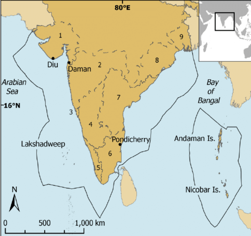
  • India is the seventh-largest country in the world. India has a land boundary of about 15,200 km.Area of India

Q5. Which mountain bounds India in the northwest?

India is bounded by the young fold mountains in the northwest, north, and northeast. South of about 22° N latitude, it begins to taper and extends towards the Indian Ocean, dividing it into two seas, the Arabian Sea on the west and the Bay of Bengal on its east.

Q6. What is the latitudinal and longitudinal extent of the mainland?

The latitudinal and longitudinal extent of the mainland is about 30°. Despite this fact, the east-west extent appears to be smaller than the north-south extent.

Q7. Why is time along the Standard Meridian of India passing through Mirzapur taken as the standard time?

From Gujarat to Arunachal Pradesh there is a time lag of two hours. Hence, time along the Standard Meridian of India (82°30′E) passing through Mirzapur (in Uttar Pradesh) is taken as the standard time for the whole country.

Q8. How is India connected to the world through the sea routes?

The Trans Indian Ocean routes which connect the countries of Europe in the West and the countries of East Asia provide a strategic central location to India.
Indian Ocean

View Answer  

Q9. How has the opening of the Suez Canal helped in reducing India’s distance from Europe?

Since the opening of the Suez Canal in 1869, India’s distance from Europe has been reduced by 7,000 km.

Q10. How have land routes contributed to the exchange of ideas and commodities since ancient times?

The land routes have contributed to the exchange of ideas and commodities since ancient times:

  • The ideas of the Upanishads and the Ramayana, the stories of Panchtantra, the Indian numerals, and the decimal system thus could reach many parts of the world. 
  • The spices, muslin, and other merchandise were taken from India to different countries.
  • On the other hand, the influence of Greek sculpture, and the architectural styles of dome and minarets from West Asia can be seen in different parts of India.

Q11. What is the number of states in India?

India has 28 states and 8 Union Territories.

Q12. Which countries share a land border with India?

India shares its land boundaries with Pakistan and Afghanistan in the northwest, China (Tibet), Nepal and Bhutan in the north, and Myanmar and Bangladesh in the east.

Q13. Which two island countries are southern neighbours of India?

India’s southern neighbours across the sea consist of the two island countries, namely Sri Lanka and the Maldives.

Q14. How is Sri Lanka separated from India?

Sri Lanka is separated from India by a narrow channel of sea formed by the Palk Strait and the Gulf of Mannar.


Q15. Distinguish between Latitudes and Longitudes.